Project finds Southeast is a bigger source of CO2 pollution than previously thought
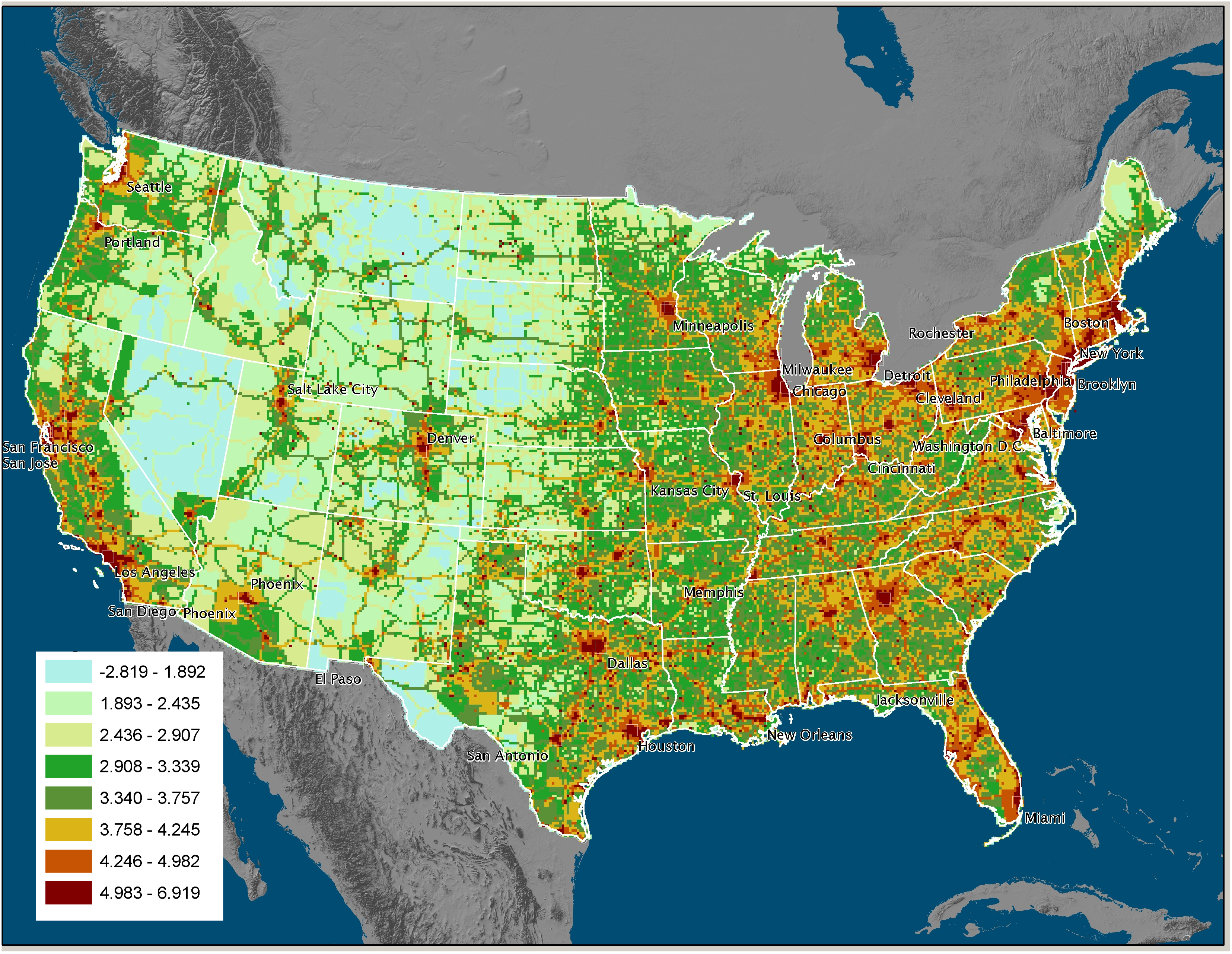 Named after the Roman god of fire, Project Vulcan is a new system for mapping carbon dioxide emissions. Funded by NASA and the Department of Energy under the North American Carbon Program, it's run out of Purdue University in Indiana. The scientists who created the high-resolution, interactive maps say they held some surprises:
"For example, we've been attributing too many emissions to the northeastern United States, and it's looking like the southeastern U.S. is a much larger source than we had estimated previously," says Kevin Gurney, an assistant professor of earth and atmospheric science at Purdue University and leader of the project.
The Vulcan data is available for download clicking here. A video of the maps and simulations of the atmospheric fate of fossil fuel CO2 also can be viewed on YouTube here.
(Map from Project Vulcan; click on image for larger version.)
Tags

Sue Sturgis
Sue is the former editorial director of Facing South and the Institute for Southern Studies.